Introducing Tanken
I made a thing! You can skip over the origin story to learn more about the app.
Tanken is a new webapp to to help people in Kanto stay active and explore Greater Tokyo. It's a free, no hassle utility, available in Japanese and English.
Origin story
I've been running 5km around my neighborhood in Tokyo three times a week for a few years now. It helped me lose a bunch of weight, get my heart in much better shape, manage stress, and build a better self-image. I still don't know if I enjoy running, but I'm glad that I do it.
There are only so many pleasant 5k routes through my area, though, and over time, I wanted to push for both variety and distance. And I wanted to take the grind of the routine exercise and have it build toward something.
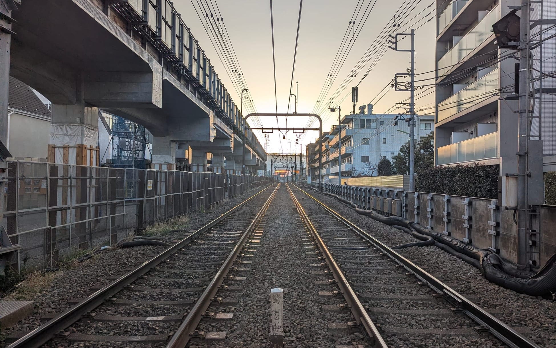
Increasing distance is straightforward: Tokyo's tangle of small streets and nigh-endless sprawl are pretty good for unstructured exploratory runs, and you're never that far from a train station if you get tired and want to get home.
A pattern emerged in my running during 2025. On weekends, I would pick a target far point and then take the train home. Sometimes I'd have to bail out with a train somewhere in between. I ran from Shibuya to Yokohama this way, and then from Yokohama to Kamakura. I ran the Yamanote Line, just to say I'd done it. I liked this pattern, and I realized that Tokyo's many train lines were becoming the scaffold for my running life.
This led to setting a 2026 resolution over the New Year's holiday:
I will run every train line in Tokyo by the end of 2026.
This is a silly goal, and when I set it, I had no idea how many train lines there really were in this city.
"A handful of Tokyo Metro lines, the Yamanote Line, the Chuo Line, a couple one-offs... It can't be more than 20 or 25 lines, right? I'll throw in the monorail and similar stuff too, just to be comprehensive."
– Jordan's intuition, 2026-01-01
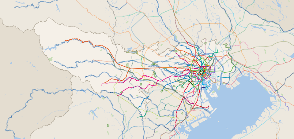
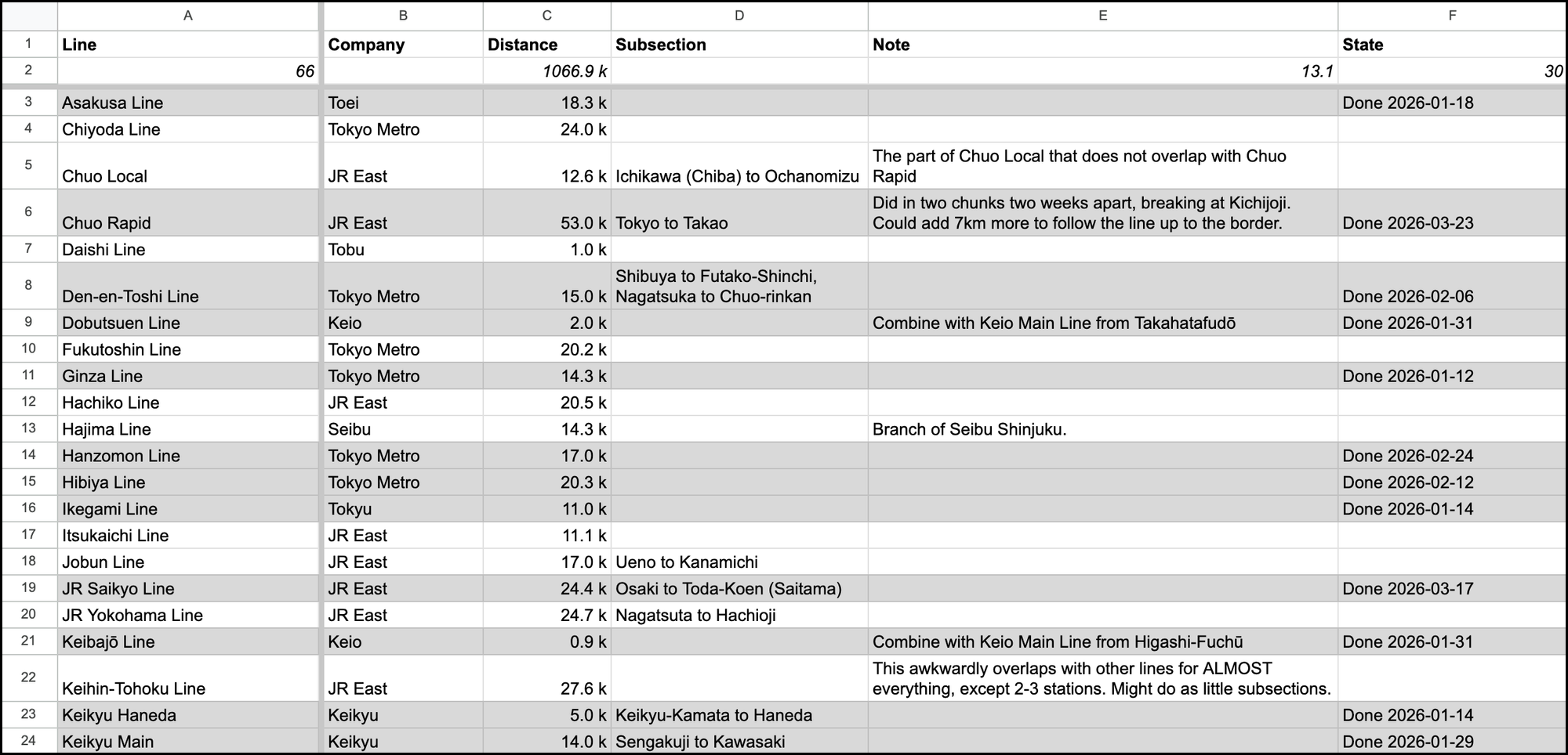
Since I couldn't find a convenient tool for listing all the train lines in Tokyo, I made a spreadsheet. As I trawled Wikipedia and Google Maps to compile the list, though, I realized I had significantly underestimated the challenge. It turns out Tokyo has 66 distinct train and train-like public transit lines, totaling about 1053km of track. And, as any resident can tell you, Tokyo is unbearably hot and humid for at least 4 months out of the year, making doing it all in one year a daunting proposition.
But I am not one to compromise on a quixotic, ill-conceived, self-imposed, no-stakes goal that no one else cares about. So I told my friends about my stupid goal, I got some affirmation (along with plenty of why would you ever do that), and as I ran, I tracked my runs in my trusty spreadsheet.
But though it tried valiantly, my spreadsheet wasn't fully up to the task. Tracking partial completion of lines was a pain. Visualizing my accumulated progress was impossible. It didn't feel like a record of accomplishment that I could hold on to for myself, or that I could share with others.
Thus, Tanken.
The App
Tanken started as a basic map utility: I just wanted to see my web of completed runs accumulate on the map. So, I extracted data from Open Street Maps and built a map. It turns out OSM data is a mess, though, so I needed a sanitization and rationalization pipeline. And then...
And then the inevitable spiral of any passion project took over, and I ended up spending a lot of nights and weekends building a public webapp that supports a range of activities (walking, running, cycling, hanami) across many kinds of outdoor spaces (rivers, trains, parks, urban trails), with goal-setting, a pretty deep metadata model for details about each route, basic user profiles that can be public or private, and a basic achievement system. It's also a progressive webapp, which makes it pseudo-installable from the web browser on a smartphone.
Tanken Screenshots
I'm under no illusion that lots of people want to run along lots of Tokyo train lines. That's not really what the app is for – though if you want to do that, this might just be the best app ever for you. And Tanken is far from the first outdoor activity-tracking app; it's not even the first one focused on urban completionists!
But those apps weren't right for what I wanted, so I built this.
My hope with Tanken is to combine local flavor and specificity, goal-setting and completionism, and an emphasis on getting the most out of living in a great city in a way that encourages being active – ideally, being active together.
That impulse to make the most out of the city is important to me. After nine years living in Tokyo, I realize how much there still is to see here, and how many opportunities I'd missed to repeating familiar places and patterns. Thus, the name: 探検 (tanken) is "exploration."
If people enjoy Tanken, there's a lot more that I'd like to do with it, including...
- Better content layer coverage of details about routes and what to see/do,
- Fuller geographic coverage and support for more activities (hiking trails),
- Basic social features to suggest activities you and your friends both want to do,
- Integrations to automatically ingest relevant activity from fitness tracking apps,
- Real native apps and the richer location-aware features they unlock.
But as tempting as it is to just keep adding stuff, I've already taken this project much farther than my inner rational product manager can permit without external validation, so it's time to show my ugly baby to the world, see if anybody likes it, and find out how real users would like it to evolve.
There's no monetization or advertising or anything like that; I just want this to be useful for other people who want to live more actively here.
If you find something useful in Tanken, if you encounter bugs, or if you have other suggestions or feedback, please let me know.
Happy trails!